Maori History Trail
Maori visited and settled in the Devonport area in the mid 14th century, approximately three centuries before the Europeans. Devonport was seen as an ideal location for settlement due to the surrounding water of the Waitemata and Manukau Harbour, which was used both for fishing and as an access point for waka (Maori canoe). Maori chose the volcanic cones of Mount Victoria and North Head for the development of pā (village or defense settlement) due to their height and volcanic soil, which is perfect for growing kumara. This trail will introduce you to the unique indigenous history of Devonport and its links to the settlement of Maori iwi in Auckland.
The Maori history trail takes approximately two hours to complete but it is up to you to chose how long to spend at each location.
King Edward Parade
The history trail begins at Devonport Wharf, where you can catch a ferry to or from Auckland City. To your right as you exit the wharf you will see a large grassy area, named Windsor Reserve. Walk through the reserve and take the road along the sea to the right, King Edward Parade.
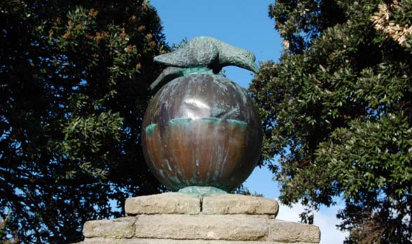
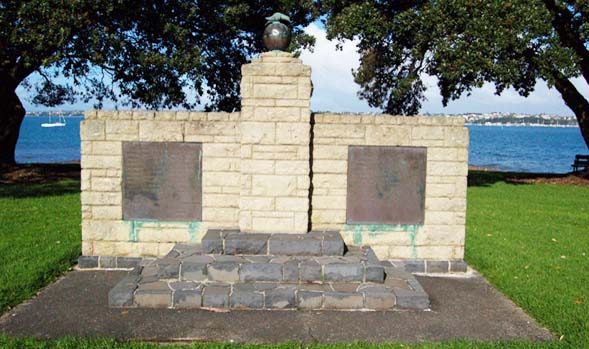
Tainui memorial
About a 15-minute walk towards the end of King Edward Parade you’ll come across a memorial on the right hand side of the road. Erected in 1959, the Tainui Memorial acts as a commemoration of the great waka Tainui. The Tainui was one of seven wakas that carried the first Maori from Hawaiiki to New Zealand. The memorial is a replica of the sacred bird image Korotangi (weeping dove) that was brought over on the waka Tainui.
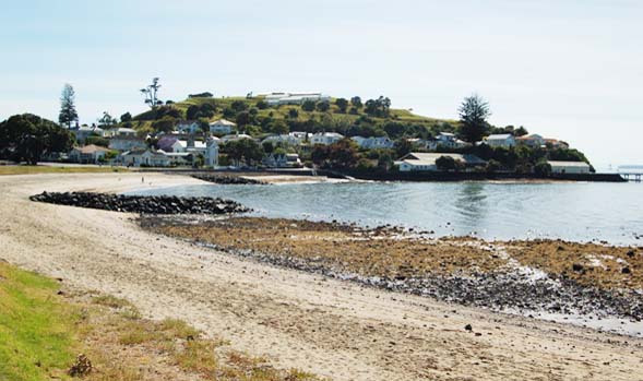
Torpedo Bay
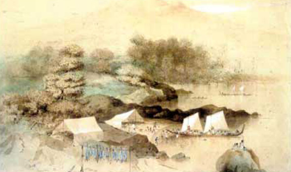
Continuing down King Edward Parade you’ll find Torpedo Bay below North Head. Known to Maori as Haukapua Beach, the Tainui waka was said to have landed at this very spot. Artefacts such as bones and tools have been found at this site demonstrating a presence of early Maori settlers. Haukapua beach was also the site of a serious battle between two Maori tribes- Ngati Paoa and Ngapuhi. Resident tribe Ngati Paoa was defeated by Ngapuhi who claimed the right to reside at this site in the 18th century.
Torpedo Bay Naval Museum Site
At the end of King Edward Parade you will see a large building, the Torpedo Bay Naval Museum. The site where the Torpedo Naval Museum stands today is likely to be one of the first campsites used by early Maori inhabitants before they settled around the wider North Shore area. In 2010 during excavation work, bones of the extinct native New Zealand bird the Moa and other Maori artefacts were found at this site. To get to your next destination To reach North Head walk along Cheltenham Road and turn right onto Takarunga Road. At the end of this road you will find the entrance to North Head.
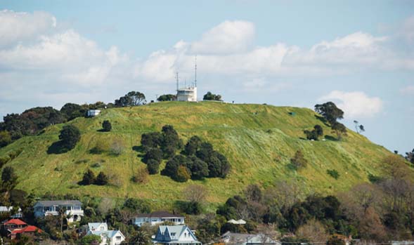
North Head
North Head is known by the Maori as Maungauika and before European colonization was a defensive pā. Most pā are found on raised ground, a volcano being the perfect position for a pā. The purpose of a pā is to protect current food supplies and the fertile lands used to plant and grow food. Early photographs of the area show that Maori used the lower slopes of North Head for gardens. Interestingly, the fortifications and earthwork defences that can be observed on Auckland’s other volcanic cones are absent on North Head. This perhaps indicates that it was predominantly the foot of the hill that was used by Maori tribes.
After the arrival of Europeans North Head was developed as a means of protection from invasion with a military tunnel complex and gun emplacements. The last remaining Maori settlement in Devonport was found on North Head but was destroyed by rival tribes in the late 18th century. As well as historic links to the past, North Head is known for its stunning views of Rangitoto Island, the Waitemata Harbour and the Hauraki Gulf. See our North Head Historic Reserve Trail page for more details.
After exploring North Head come back down onto Takarunga Road, turn right onto Cheltenham Road and Take the first left onto Tainui. Walk along Tainui Road turning left onto Vauxhall Rd and take the first right onto Albert Road.
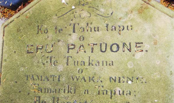
Grave of Chief Eru Patuone
Continue along Albert Road and just past the Lake Road roundabout to the left you will find the old Devonport cemetery. Inside is the grave of Maori Chief Eru Patuone (the peacemaker). Eru Patuone was born in 1764 and lived for over 108 years, until 1872. Patuone lived during the early years of Pakeha settlement in New Zealand and thus witnessed and played a key role in a number of events that shaped modern New Zealand.
Patuone was known as the peacemaker due to his relationships with both Maori and Pakeha and his role as a mediator between them. During his life Patuone had a relationship with all of New Zealand’s Governors and was consulted by them regarding Pakeha Maori relations. Patuone was particularly close with Governor Grey (who served two terms as governor in 1845 and again in 1861) and when all Maori were required by Grey to sign an oath and give up their arms or move out of the area, Patuone remained close by in Takapuna on land gifted to him by the Governor.
The upper slopes of Mt Victoria can be reached via a number of different grass trails, however these become more challenging in the winter months. To reach the main entrance of Mt Victoria come back out onto Albert road and continue walking, at the end turn left onto Victoria Road. Continue down Victoria Road and take the slight left onto Kerr Street. On the right you will find the main entrance to Mt Victoria, the highest volcanic cone on Auckland’s north shore.
Mount Victoria
Mount Victoria, known by Maori as Takarunga was originally the main pā in the Devonport area. Historically, Takarunga was occupied by a number of different iwi (group or social unit in Maori culture). Evidence of the mountain’s historical uses such as pā terraces and pits associated with food-storage and settlement areas can be seen on the northern slopes today. Since European settlement, Mt Victoria has been used for artillery emplacements, farmland and various concrete army bunkers. Today, Mount Victoria is a popular spot for tourists and locals alike with some of the best views in Auckland. The summit of Mount Victoria provides a panoramic scene of the Waitemata Harbour and Hauraki Gulf unique to this viewing point.
After walking down Mt Victoria you will come back out onto Kerr Street. Continue along this street and turn left at the end onto Victoria Road, the heart of Devonport. You have now reached the end of the Maori History Trail. If time allows, stop for a well-deserved break at one of Devonport’s many cosy cafés or restaurants which line Victoria Road for refreshing drink or snack.
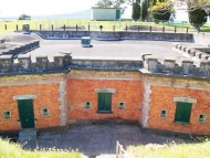
Fort Takapuna Devonport
FAMILY FRIENDLYFort Takapuna is a lookout point and bunker defence site and the last of the New Zealand designed twin 6 inch gun forts in existence. The fort is below ground level as originally a dry moat surrounded the fort on all sides, with a drawbridge to provide access.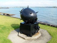
Devonport Military History Trail
FAMILY FRIENDLYNamed after the Devonport naval base in England, Devonport is home to the Royal New Zealand navy and is rich in maritime history. The Military History Trail is the perfect introduction to Devonport’s historical connections with the military service and one of a kind views from Devonport’s unique military strong points.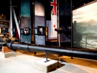
Devonport History Trail
FAMILY FRIENDLYThe History Trail is a must-do for history buffs or those wanting to further explore the fascinating history of one of Auckland’s oldest areas. Discover two volcanic cones, iconic Devonport architecture and historic sites and memorials dedicated to commemorating Devonport’s unique role in New Zealand history.